

- Stock:
- Model: KP27A/wf
Description
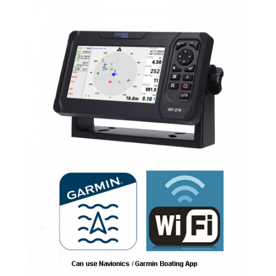
Please note....The Boating App is a download on your phone or tablet, it doesn't reside in the KP-27A which has its own UK chart pre-installed.
This KP-27A is unusual in that it has a wi-fi transmitter installed. This has been set up and tested for use with Navionics Boating App but will work in the same way with any similar boating App that can process and show AIS overlaid onto its chart.
Full manufacturer's 2 year UK warranty, all technical support is UK based. The KP-27A Includes base mount. power data cable, Puck type (small) GPS aerial, user documentation and sun cover. Latest 2025 firmware installed. Your AIS details will be set into this KP27A so that it is ready to use if you provide AIS information ( see* below for the information needed. No problem if you don't have that as full instructions will be provided to do this yourself if we don't receive your AIS details.
General information of this product:
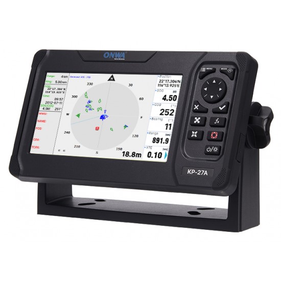
KP-27A, 7 inch MDD chart plotter that has a built in Class B+ AIS transceiver. All Onwa AIS products have a Class B+ AIS transceiver since the very first development of Class B+. Class B+ is the later version of the original Class B system but having five Watts output and using SOTDMA transmitting technology (Class B is CSTDMA). SOTDMA is superior to Class B CSTDMA, not only in being higher power, but also in enabling a transmitting vessel to access a transmission slot in the AIS system even in AIS crowded waters. Original old Class B can reserve a slot but if the AIS system is in heavy use the slot is not guaranteed so it may not be able to transmit until a slot is available. SOTDMA also has an advantage in that the transmission is sent more frequently if the speed of the vessel increases which is highly desirable for high-speed craft such as a RIB. Features of the built-in KP27A AIS transceiver:
- Wi-Fi transmitter installed and configured to use Navionics (Garmin) Boating App
- AIS targets overlaid on the chart
- Class B+ SOTDMA (same technology as Class A)
- Receive sensitivity = > -123dBm (2 channels)
- Transmit power = > +36.999 dBm (1 channel) 5 Watts
- User adjustable CPA and TCPA alarms (CPA = closest point of approach, TCPA = time to CPA)
- Vessel list shows a list of all AIS vessels transmitting within reception distance selecting any one will show other vessel details including: Vessel name, MMSI, Position, COG, SOG, vessel size and its distance away from your own boat. Note that any vessel calculated to be on a collision course and being inside of CPA or TCPA boundaries will trigger an alarm alert on chart screen and also in detail on the AIS screen.
- AIS target tracking, selecting any vessel enables tracking of that vessel, up to 10 vessels can be selected.
- 1000 nits brightness
- 800 x 480 screen resolution
- IP66 water rated
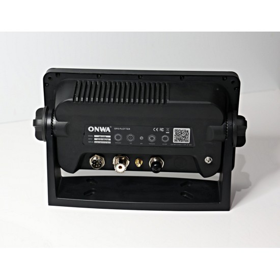
- NMEA2000 data
- NMEA0183 data
- Water protection to IP66
- 12000 User waypoints, 30 routes
- Worldwide tidal data information calculated from GPS position/Date/Time
- Alarms: Anchor drag, XTE, arrival, speed, proximity waypoint, voltage
- Charts: Compatible with Onwa K-chart V2 and 3.2, Navionics +, C-map Max
- Celestial: Sunrise, Sunset, Moonrise
- Charts: Comes with FREE Onwa K-chart for the UK and Ireland (covers Northern France and Holland as well). If you are buying for use in Europe or beyond, Onwa have a chart for your area which can be substituted for the UK chart. Can use Navionics + chart or C-map max chart

Aerials: GPS. Puck type GPS aerial included, can be used below deck in a GRP boat provided deck material does not attenuate satellite signal unduly.
Options:
AIS aerial: an AIS aerial is needed for transmission and reception of AIS. Choice of flexible/stubby or stainless whip. Flexible/stubby is particularly suited for low level mounting where a whip type may be vulnerable to damage by crew or the deployment of lines. Aerials we supply are specifically tuned to 162mHz the frequency of the two AIS channels and we use low loss RG8X 50-ohm cable which we cut to your specified length. Cable can be supplied with two high quality PL259 connectors fitted or with one only which greatly facilitates installing the cable though tight spaces or a deck fitting. If you choose one end only fitted, the free cable end is prepared using a professional cutting tool so that the second connector can simply be screwed onto the cable and the centre tip soldered.
* For your AIS to be set up we require:
MMSI number
Call sign
Boat name
Vessel type...... e.g. sailing, power only, fishing, diving, etc.
Length
Beam
If you don't provide this information the plotter will be dispatched with instructions on the process
Beware buying from an unauthorised source. Imports from outside the UK may be subject to UK import Vat/Duty charges by HM Customs. Warranty, if any, may mean returning to China at your expense and incur additional UK VAT on re-import to UK. Products manufactured for sale in Asia may not comply with UK and EU standards and be illegal to use, particularly relevant for an AIS transceiver (transponder) as this transmits your identity.


-190x190w.png)
